Brad Olson
TVWBB Diamond Member
When: Saturday, Feb. 25, 2023, 2:00 PM
My wife and I were in Mountain Home to visit her parents over a long weekend, so that Saturday afternoon we grabbed a late lunch at Holy Smokes BBQ, located on AR-201 on the north side of town. You rarely see trucks that old looking that good here in the Salt Belt!
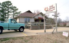
The entrance is on the south side of the building, and that's the kitchen to the left.
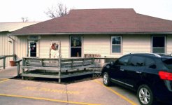
We decided to split a 3-meat platter containing pulled pork, ribs and brisket, with beans, smoked mac 'n' cheese and potato salad on the side.
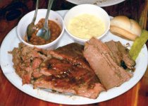
Count me as a fan! The pork was plenty moist with both Mr. Brown and Mr. White being well-represented, the ribs had excellent texture and required a little bit of work to get the meat from the bone, and the brisket was nice and beefy. I couldn't tell if the beans were made from scratch or were a doctored version (which I'm perfectly fine with) but they had plenty of meat and very good flavor. We both liked the mac 'n' cheese and my wife said the potato salad was also very good, and while I would've liked more smoke in the brisket I think I say that pretty much all the time.
And now for the travelogue portion of the post, so grab your maps and follow along. We tried a different route to Mountain Home this time, taking MO-181 south from Cabool to County H and then H south to US-160 west of Caulfield (we were supposed to take H to PP and then PP south to 160, but missed the turn). In this photo the camera's facing north and we came out of the woods and to a dead stop when we saw this.
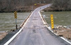
This is the Patrick Bridge over the north fork of the White River and apparently during high water the river can be as much as 5 feet over the roadway. So what's normal? This is:
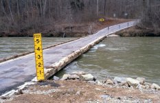
Yikes! We cautiously made it across the bridge but being that close to the water (and it was moving) was just a bit unnerving! Next time we won't miss the turn onto PP!
My wife and I were in Mountain Home to visit her parents over a long weekend, so that Saturday afternoon we grabbed a late lunch at Holy Smokes BBQ, located on AR-201 on the north side of town. You rarely see trucks that old looking that good here in the Salt Belt!

The entrance is on the south side of the building, and that's the kitchen to the left.

We decided to split a 3-meat platter containing pulled pork, ribs and brisket, with beans, smoked mac 'n' cheese and potato salad on the side.

Count me as a fan! The pork was plenty moist with both Mr. Brown and Mr. White being well-represented, the ribs had excellent texture and required a little bit of work to get the meat from the bone, and the brisket was nice and beefy. I couldn't tell if the beans were made from scratch or were a doctored version (which I'm perfectly fine with) but they had plenty of meat and very good flavor. We both liked the mac 'n' cheese and my wife said the potato salad was also very good, and while I would've liked more smoke in the brisket I think I say that pretty much all the time.
And now for the travelogue portion of the post, so grab your maps and follow along. We tried a different route to Mountain Home this time, taking MO-181 south from Cabool to County H and then H south to US-160 west of Caulfield (we were supposed to take H to PP and then PP south to 160, but missed the turn). In this photo the camera's facing north and we came out of the woods and to a dead stop when we saw this.

This is the Patrick Bridge over the north fork of the White River and apparently during high water the river can be as much as 5 feet over the roadway. So what's normal? This is:

Yikes! We cautiously made it across the bridge but being that close to the water (and it was moving) was just a bit unnerving!
